I’ve been a frequent user of OpenstreetMaps for Android (Osmand) for many many years. It is packed with features and does everything for me from finding nearby businesses, adding and editing features on the map for the community to navigation advice, i.e. routing, over large distances. However, over the years I’ve noticed a gradual slow down when I zoom in and out of maps or swipe in any direction to see a different part of the map. It got to a point with my Pixel 8 and GrapheneOS where I really started to get annoyed and actively started to look for something different. And it seems there is a very good and privacy respecting alternative: CoMaps, a recent fork of OrganicMaps.
CoMap Features
CoMaps as a fork of other projects has been in development and evolution for many years, and yet it seems they want to stick with simplicity. Fine for me, because I don’t need 95% of the features of Osmand. And if this helps to get a faster and smooth map experience on my smartphone, the better it is.
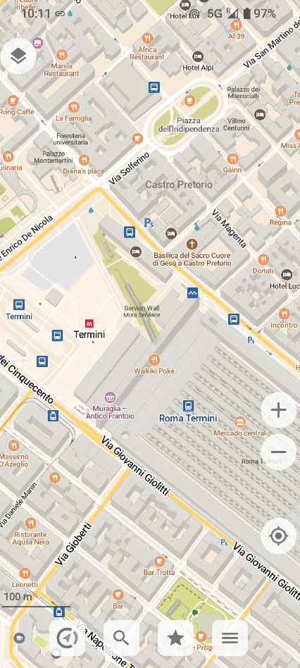
My first impression after starting the app: ‘Wow, the map looks very nice’. The second impression after checking how zooming in and out of very complicated parts of a map, like the city center of Rome or any other big city was ‘wow, this is really fast and smooth’. Then I checked how searching for a nearby place would work. If you are looking for a specific place in Osmand and only mistype one character of the name in the search, the place is not found. CoMaps is a lot more fault tolerant while searching and also brings up similar typed results. Wow, that’s exactly what I missed in Osmand, as I often mistype place names due to the small on-screen keyboard or simply because I don’t know the exact spelling. Pedestrian, bike and car routing to a search result or selected place works as well. After putting in my Openstreetmap account details, CoMaps also lets me edit places on the map or create new ones for the community, and I really like the interface.
What I’m Still Missing
After all these praises, there are two things that I’m unfortunately missing: Help with local transportation such as busses is not yet included, so I have to resort to Osmand or a proprietary solution to find out how to get to a place with public transportation. And one other, albeit minor thing: I am missing an option to see the distance I have walked or biked from an initial location. There is the option to record a track and see statistics after the recording is stopped, but I haven’t found a way to show current statistics for the track while I’m still underway. There are descriptions on the web to bring this up, but it doesn’t work for me. Perhaps a temporary bug? Perhaps, but this is another thing I have to revert to Osmand to for the time being.
So much for today. In the next post, I’ll have a look at how ‘private’ and ‘offline’ CoMaps really is and how location sharing works.