In part 2 of this series, I’ve been looking at resources available from books to videos on Youtube to learn flying in the virtual domain. For me, a mix of real world examples and examples shown with a simulator made most sense. So for a couple of months I was flying happily on the simulator on the X-Box and picked up some interesting apps along the way that people use for flight preparation and during flight in the real world. As my goal is to fly as realistically in the simulator as possible, I had to change tactics a bit to also use those tools in the virtual world.
VFR (Visual Flight Rules) flying in Europe is a bit challenging, because there are so many restricted areas one must not fly through and control zones (hello Charlie Airspace…) one can only traverse from specific waypoints and after having received permission over the radio. Before the advent of smartphones and tablets, pilots had to study maps and carefully plan their route on the map and paper. An arduous task. But in the past decade, flight planing software on PCs and tablets have made their way into the flight planning process and into the cockpit, especially when flying larger distances. Two of those are Foreflight and SkyDemon, and the difference between analog and digital flight planning is like night and day.
Flight Planing
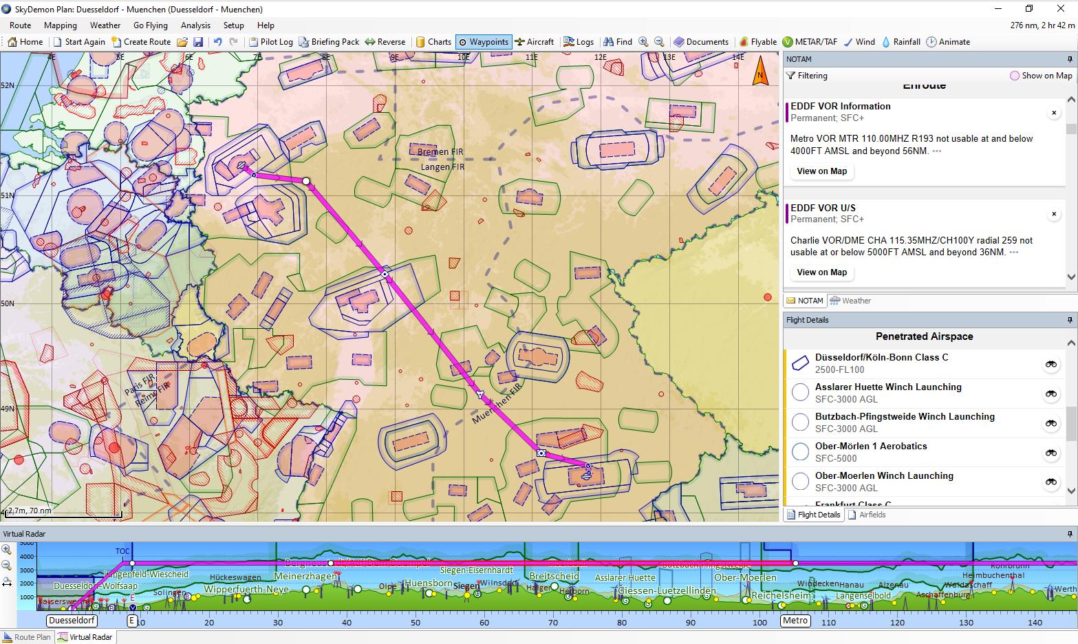
When planning a route, one selects a departure and arrival airport on a map and an altitude to fly, and the software will immediately show you where the straight line route will cross restricted areas and controlled airspace. One can then insert waypoints and drag them over the map to fly around such airspace, or change the intended altitude for parts of the flight path to fly above or below those areas. Piece of cake! Also, the software bundles all information that otherwise has to be pieced together from many different sources, particularly airport information such as runway information (length, direction), traffic patterns to be used for the approach, mandatory visual reporting points one has to fly over when departing or arriving at a controlled airport, radio frequencies of airports and air traffic control, opening times, official Aeronautical Information Publications (AIPs), fuel availability, comments about the airport from other pilots, maps, etc., etc. I guess you get the idea. While there are free alternatives available to Foreflight and SkyDemon, they only implement a subset of the afore mentioned features, and I quickly decided that it’s worth to spend around 10 euros a month for SkyDemon. Note that I didn’t compare SkyDemon to Foreflight, as I saw how SkyDemon was used in a number of videos on Youtube and decided that this is what I need.
Navigating with SkyDemon in the Simulator
For flight planning, SkyDemon or Foreflight will work nicely in real live or with MS Flight Simulator on the X-Box, there is no difference. However, the second major value of these software packages is that they can be used on a tablet during flight for navigation purposes by using the tablet’s built in GPS. Obviously, the GPS output of the tablet doesn’t help for flight simulation. Fortunately, both software packages allow alternative location and altitude data input from other sources over the network, i.e. over Wi-Fi. On the other end of the chain, flight simulators can export their virtual GPS information in real time, and open source plugins have been written by third parties to pick up this information and send it over Wi-Fi to SkyDemon or ForeFlight on a tablet in the same network. The catch: The X-Box does not support 3rd party plugins, so there is no way to use SkyDemon or Foreflight in combination with MS Flight Simulator 2020 on that platform.
So after a while, I decided that I really wanted to use the software for navigation as well, which ultimately meant I had to move to the PC as a platform. This in turn meant that I had to invest into new workstation hardware. Depending on your budget, this will mean a visual quality reduction of how the world is rendered, or quite an improvement if you are willing to spend a bit more on the hardware. In the end, I decided to go for a Lenovo Legion workstation with a water cooled Intel 12700KF processor and an Nvidia RTX 3080 graphics card. While definitely improving on the already excellent graphical quality of the X-Box, it has enough compute capacity left to be able to record flight sessions with OBS Studio. And of course, I now had access to the flight simulator’s GPS data to pipe it into SkyDemon running on a tablet on the side of the screen while flying. As expected, this brought my VFR flight experience on the simulator to a whole new level, as I can now use the same software in the simulator as is used in real life for navigation in small airplanes. Fantastic!
What’s Next?
The next challenge: When flying cross-country, one usually has to talk to air traffic controllers, even when flying VFR. The simulators built-in ATC simulation is OK-ish for starters, but real live is quite a bit more complicated. But there’s a fix for this as well: Vatsim! More about his in the next episode.