When flying with Visual Flight Rules (VFR) in the simulator, I’ve come to rely on SkyDemon, a real world tool to plan VFR flights and then use it during the virtual flight to find my way and to avoid ‘Charlie’ airspace and restricted areas. When flying with Instrument Flight Rules (IFR), other real life tools such as ForeFlight are an interesting option to use in the simulator. However, ‘the Internet’ seems to conclude that the combination of SimBrief and Navigraph for flight planning and flying is a better alternative for the simulator. I was a bit skeptical at first, because I want my simulator flying as close as possible to the real world, but I gave it a try anyway. So here’s how that went:
Flight Planning
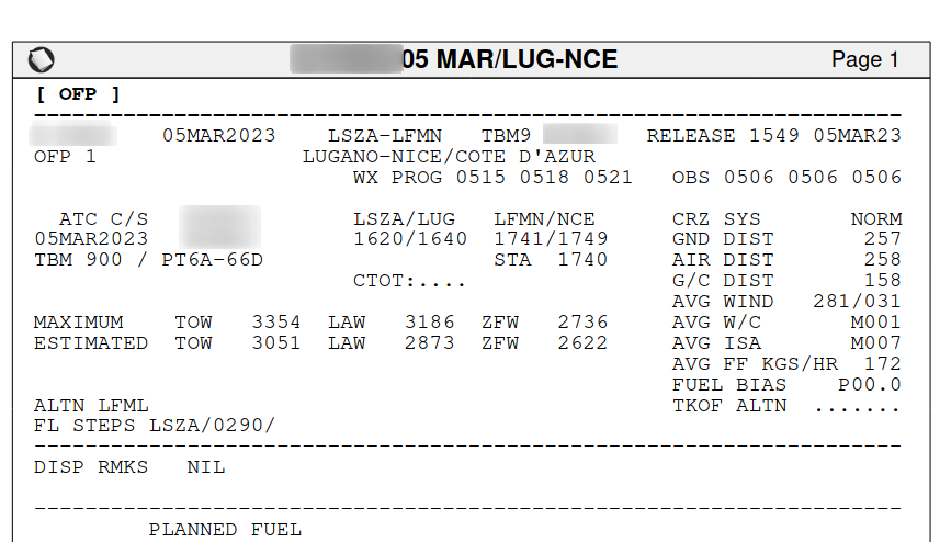
When flying IFR, one needs to plan a route along waypoints and airways, and then file a flightplan. While planning a route can be done manually based on airport, departure, enroute and arrival charts that are available from various sources, there are routing tools available that will make this exercise much more convenient. SkyVector is a free tool to use and works for real life and simulation alike. Another handy tool, particularly for simulator use is SimBrief, as it does not only generate a route, but also a flight plan based on your aircraft type, which includes departure and arrival runways, the standard instrument departure (SID) and Standard Arrival (STAR) parts of the route, an estimate of the flight time and fuel consumption, alternate airport routing, weather information, NOTAMs for the route, best altitude for flying, etc. etc. There is a free and paid version of SimBrief with the only difference being that the free version uses a somewhat outdated AIRAC routing data version. A nice detail: All information is shown in the browser in an easily readable format and also in formats used by airlines, such as LIDO (Lufthansa Integrated Dispatch Operation). While the learning curve for reading a 50+ page LIDO flight plan is a bit steep, it’s what is used in practice by many airlines and one gets used to the format very quickly and comes to appreciate it.
Maps
While SimBrief does the heavy lifting of finding a route, it does not include the airport, departure and arrival maps, also called charts or plates. Fortunately, the charts and all textual information surrounding them are available free of charge from the aviation authorities of most countries. As every country has their own website and way to access the information, getting the required maps together for international flights is a bit of a pain. While the free ChartFox web app can help to find and navigate the map portals of many countries, it still requires a bit of effort to put things together.
To get to the charts even quicker and get an excellent situational awareness during the flight, I then had a look at Navigraph. For 10 euros a month subscription fee, which also includes the latest AIRAC cycle for SimBrief, one gets an excellent chart tool that can import a flight plan from SimBrief and then automatically loads all relevant maps for the flight. That includes the departure airport chart, so you know how to get to the runway, the Standard Instrument Departure (SID) chart, the waypoints in between, the Standard Arrival (STAR) chart, and of course the destination airport chart. The charts are the simulator version of charts created by Jeppesen, a company that provides standardized global aeronautical charts and information. Especially when flying internationally, the great advantage is that one not only doesn’t have to search for the charts, but they are all assembled in the same way. This saves one a lot of overhead to get used to the various national formats. Not that this can’t be done, but it makes life before and during the flight a lot easier. Also, Navigraph can overlay the charts on top of the route, and by connecting to the simulator, it can show the current location of the plane in real time on the overall map. Again, an invaluable feature to increase situational awareness and reduce the workload during a flight when air traffic control suddenly changes your beautiful plan due to traffic. From a reality point of view, I was wondering how ForeFlight and other tools could and would do this ‘in real life’. It turns out that even airliner pilots today use tools supplied by their airlines on tablets and smartphones that work exactly like this. And when you have a closer look at the systems built into modern airlines such as the Boeing 787, it’s done very much like this as well. So I’m also very happy from a ‘reality’ point of view.
Summary
Sorry for not putting more screenshots into this post, but I’m not sure how leerily charts and other copyrighted material are ‘guarded’. Therefore, if you want to get an impression of how the tools look like, click on the links provided in the post. From my point of view, the combination of SimBrief and Navigraph look and feel very much like the tools used in real life flight planing and as support tools for providing maps and situational awareness before and during an IFR flight. Therefore, highly recommended! Happy flying!