There obviously had to come a time when the interests of the wireless network engineer in me and my enthusiasm for flying in the simulator cross paths. Even small general aviation aircraft have lots of radios on board these days and if you go up the price range a bit, there are even built-in satellite communication options available. And when moving up the scale to airliners, satellite communication for voice calls and data exchange is a standard feature. So let’s have a look at these capabilities.
Small Planes
In small general aviation airplanes mostly flown by private pilots, glass cockpits like the Garmin 1000 and up have satellite navigation (GPS) capabilities built-in which is a tremendous help for VFR and IFR flying alike. And those flying with traditional analog instruments typically use a tablet today with navigation apps such as SkyDemon. That’s satellite receive only, however. Additional satellite communication options available are getting weather forecasts during the flight via satellite, which is particularly useful for longer flights. Apart from simple text based weather forecasts, Garmin’s Connext service also delivers weather radar images via satellite, so pilots can see where to expect problematic clouds and rain during a flight and how to potentially circumnavigate them. According to Garmin’s website, the Iridium satellite network is used for the service. In addition to weather data, the satellite communication modules can also be used for texting and making phone calls. All of this is optional for flying, but if money is no object, the plane might as well have all the bells and whistles. Here’s a link to a discussion among pilots on the topic that will give you further insights. And for planes without a glass cockpit, standalone versions of such equipment is also available.
Airliners
When you look at airliner videos on Youtube, you can see satellite based information systems like this one from Airbus in action. While airliners typically make use of ground based traditional VHF radio links for voice and data, satellite communication is also an option when flying in areas where ground based networks are not available. The link above describes three different types of satellite based communication in an airliner that I have abbreviated below:
The first is for the cabin use, i.e. Internet access for passengers. The second is for text based air traffic control communication, e.g. for clearing a flightplan, for air traffic controllers to change flight level assignments, give instructions on speed and route changes, etc. This is typically done over a ground based VHF link, but can also be done over satellite. This article on the CPDLC system for air traffic control mentions that Inmarsat is one of the satellite constellations used for the purpose.
The third type of satellite service used in airliners is used for communication between pilots and their airline companies. Information that is frequently exchanged are things like flight plan updates, manifests, plane performance data, connecting flight information for passengers, etc. Again, a ground based VHF radio link is used if possible, with satellite being an option when flying to areas where an airline company VHF channel is not available.
Let’s also have a quick look at data rates: Traditional VHF data communication in the airline industry and satellite communication is very slow by today’s standards. A typical data rate of a VHF or satellite channel is around 31 kbps. Airbus’s current satellite based system for airline company communication operates at 200 kbps. And while older systems use an aviation specific protocol to transfer data, the newer system is based on the IP protocol.
Satellite Communication in the Simulator
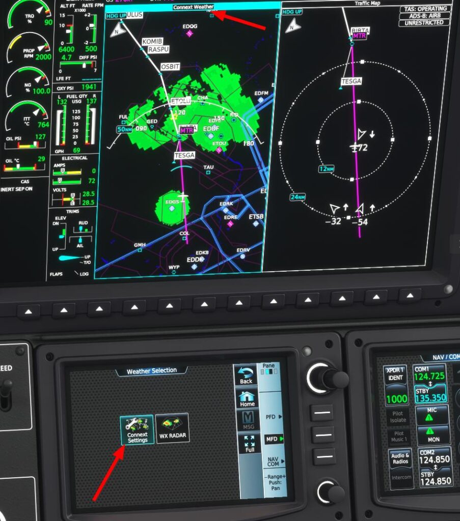
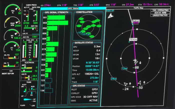
Interestingly, many of the systems mentioned above are also part of flight simulation. In MS Flight Simulator 2020, satellite based navigation is emulated for all planes with a glass cockpit. The flight management system of some emulated planes like the Daher TBM930’s Garmin 3000 even have a screen that shows the current satellites received (first screenshot above) and has a working simulation of the Connext weather radar service (second screenshot above). And when it comes to VATSIM, the CPDLC data service is supported for virtual air traffic control as an addition to traditional voice communication. And this is where the circle closes, as I wouldn’t have started to investigate these topics further if I hadn’t seen and used some of these things in the simulator.